Koalas and Greater Gliders Detected During Kangaloon Drone Survey
Published on 04 December 2024

Years of monitoring in the Upper Nepean State Conservation Area (north of Kangaloon) has revealed a high-density, thriving population of koalas. However, no systematic surveys have been conducted on nearby private land since a radiotracking study in 2015.
In July this year, Wingecarribee Shire Council conducted a small-scale thermal drone survey on private properties in Kangaloon and surrounding localities to answer one very important question: are koalas using the fragmented, but high-quality bushland on private property, or are they mainly residing in the larger intact areas of bushland such as the Upper Nepean SCA?
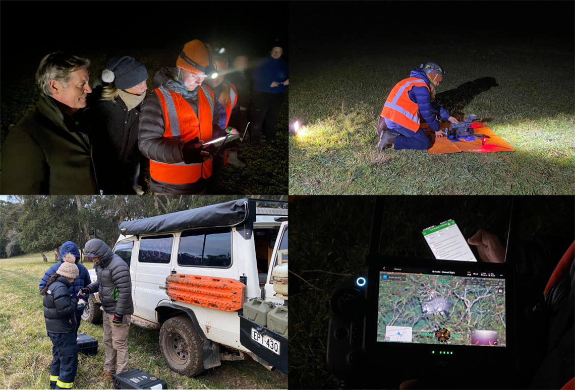
Council invited landholders with over one hectare of eucalypt forest to participate in a thermal drone survey to understand more about koalas and other wildlife. Thermal drones are an emerging technology which allow fast and cost-effective surveying of bushland, including hard-to-access areas.
Two highly skilled drone pilots from Escarpment Ecology conducted 17 drone flights covering 287 hectares of bushland on private properties in Kangaloon, East Kangaloon and Glenquarry and detected 103 arboreal mammals (Table 1). The survey took place over 5 nights, with each property being surveyed once.
We found that koalas (Phascolarctos cinereus) and southern greater gliders (Petauroides volans) are using the small but high-quality remnant bushland on private property in Kangaloon and surrounding localities (Table 1). This survey highlights the importance of remnant bushland for providing habitat for wildlife. For example, one koala was detected in a corridor of vegetation only 40 metres wide which connects to a larger 50-hectare remnant.
The large difference in the number of koalas detected compared with greater gliders reflects the difference in their home range sizes, with home ranges of koalas ranging from 30-160 hectares locally compared with 1-3 hectares for southern greater gliders. The number of koalas detected is also likely an underestimate because each property was only surveyed once. Repeat surveys will improve the detectability of animals like koalas which can have large home ranges and likely move between private properties and surrounding public land.
Table 1
| Species detected |
Number of individuals |
| Koala |
2 |
| Southern Greater Glider |
39 |
| Common Ringtail Possum |
19 |
| Common Brushtail Possum |
43 |
Table 1. shows the total number of arboreal mammals detected using the thermal drone (see video footage).
Koalas and greater gliders are listed as endangered. They both rely on Eucalypt forest for their food and shelter. Greater gliders shelter and nest in tree hollows, which can take hundreds of years to form. Tree clearing, climate change, and disease are huge threats to these endangered species, however, you can help ensure their survival by retaining hollow-bearing trees and bushland on your property and planting new eucalyptus trees to expand or connect koala and glider habitat.
To learn more about making your property wildlife-friendly and to get involved in future survey opportunities, join one of Council’s free private land conservation programs Habitat for Wildlife or Land for Wildlife (for properties with >0.5 hectare of bushland).
For more information about Southern Highlands koalas, visit www.wsc.nsw.gov.au/koalas and follow the Southern Highlands Koala Conservation Project on Facebook and Instagram. You can learn more about Southern Greater Gliders here: https://wwf.org.au/what-we-do/species/greater-glider/
All participating landholders were notified of the results of the survey. Data from this survey will be uploaded to BioNet, the NSW database for wildlife sightings, and will contribute to the development of Council’s koala habitat map and plan of management.
This survey was funded by the NSW Koala Strategy and Wingecarribee Shire Council. Thank you to all the participating landholders who provided access to their properties for this survey and to the drone pilots at Escarpment Ecology for their skills and expertise.